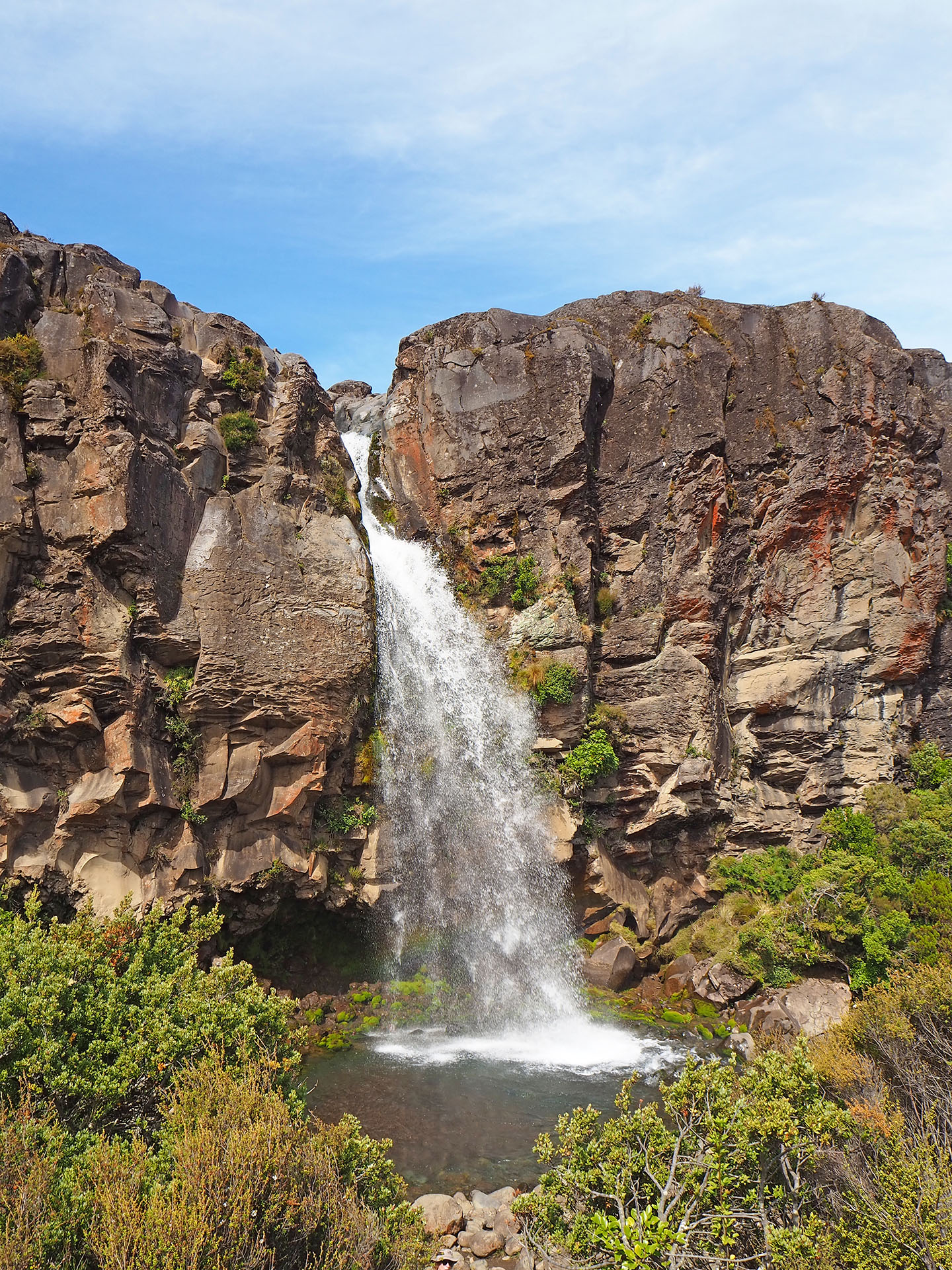
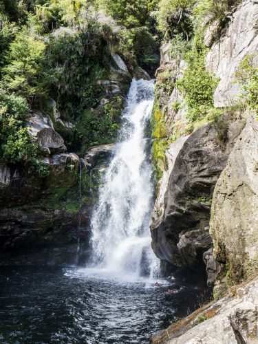
We just did a short morning hike (2h) to the Taranaki Falls before heading to Waitomo.
Taranaki Falls
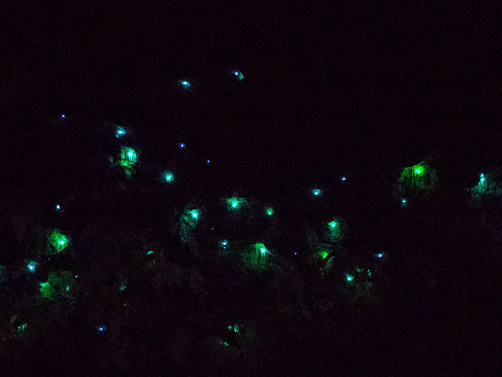
It was a hot day (30°C) and we waited on the campground for an evening adventure. On the Ruakuri Walk you can also see glowworms after sunset. Yep, we spotted them – it was like walking in a fairytale forest. And it was for free! 🙂
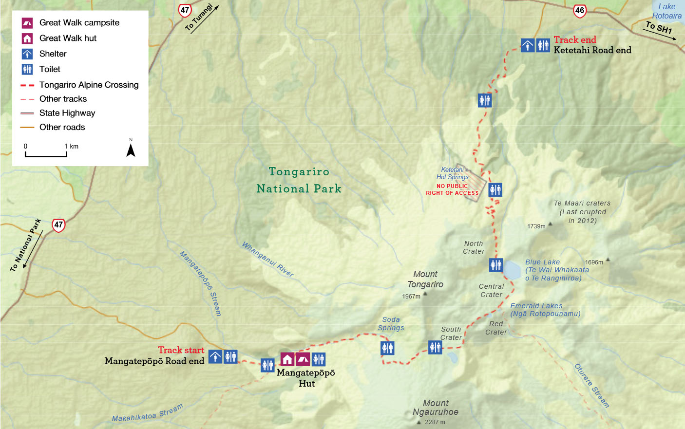
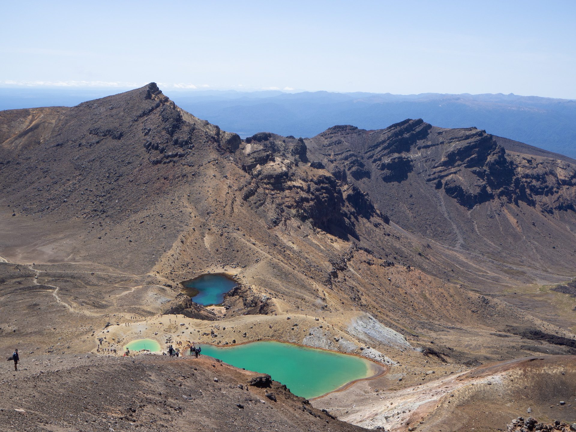
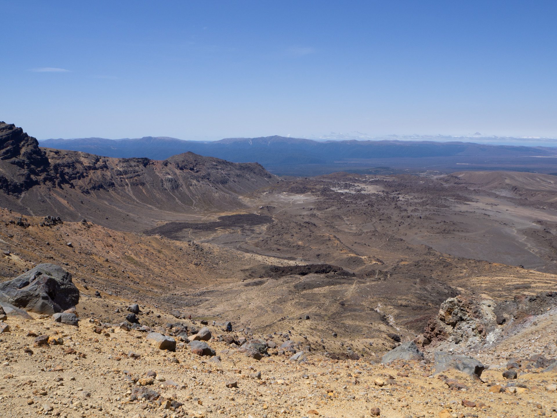
Grey sky, clouds and even drizzling rain. Not a very promising beginning of the day. But we knew the forecast and hoped for better weather on our much-awaited hike: Tongariro Alpine Crossing, according to several sources one of the best day-hikes in the world:
“Trek across a volcanic alpine landscape of dramatic contrasts – steaming vents, glacial valleys, ancient lava flows, alpine vegetation and vivid crater lakes, all with stunning views.”
Tongariro Alpine Crossing map
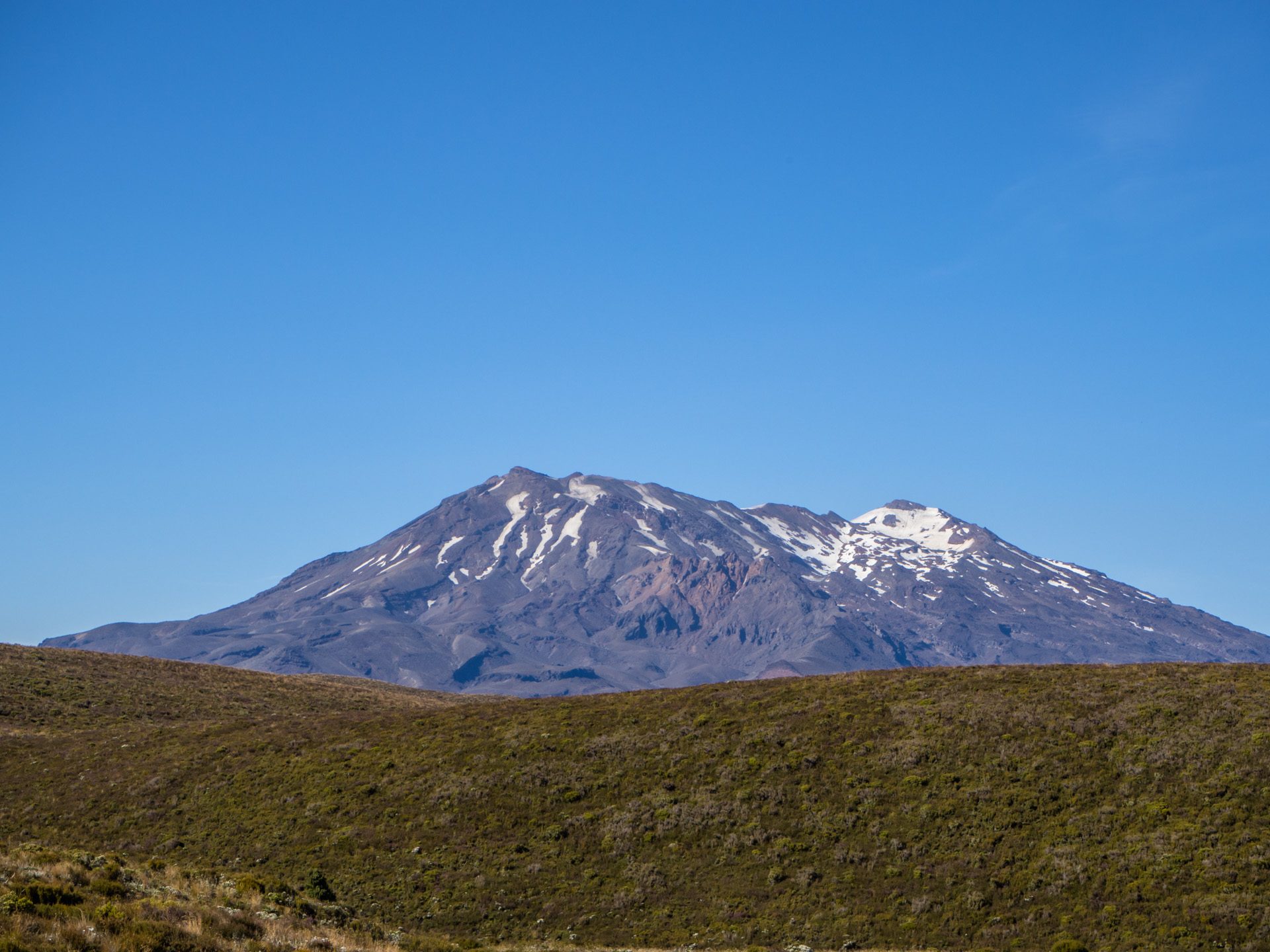
A hike which also got a popularity boost after the screening of the Lord of the Rings trilogy, as the volcano Mount Ngauruhoe was used for Mount Doom of Mordor.
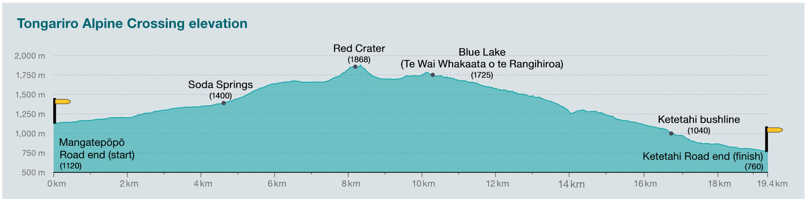
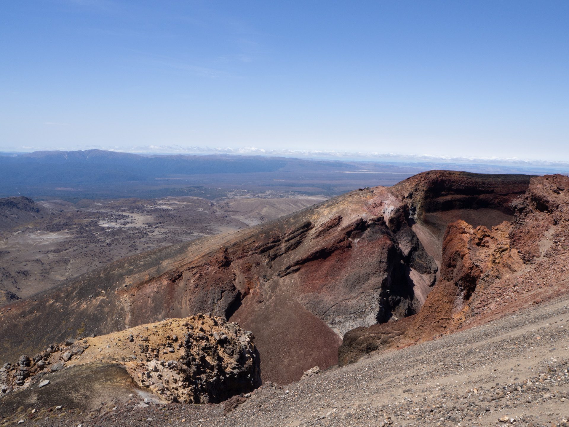
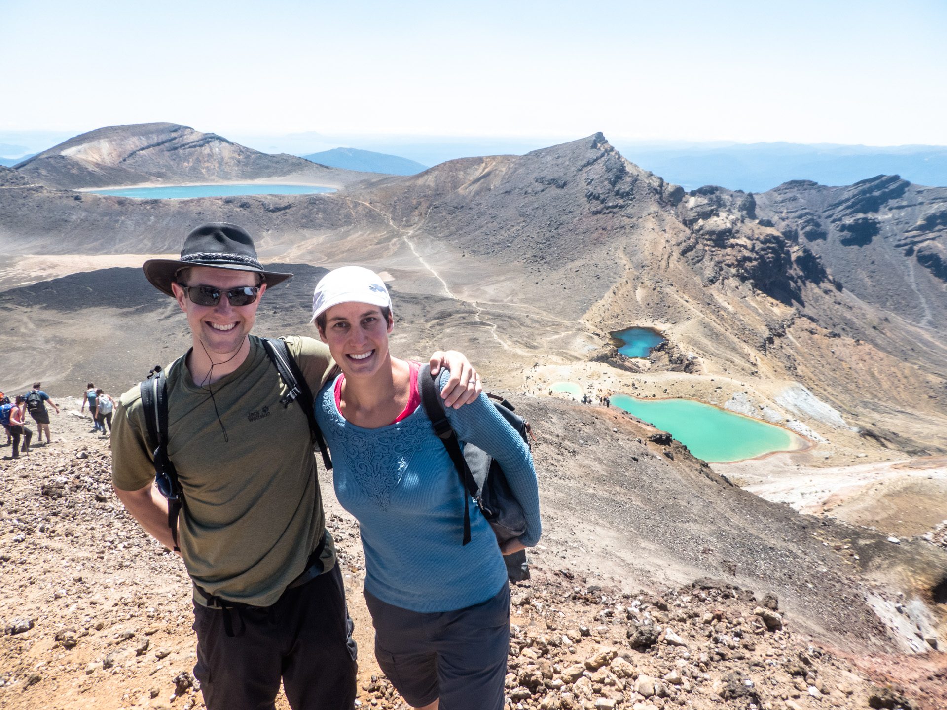
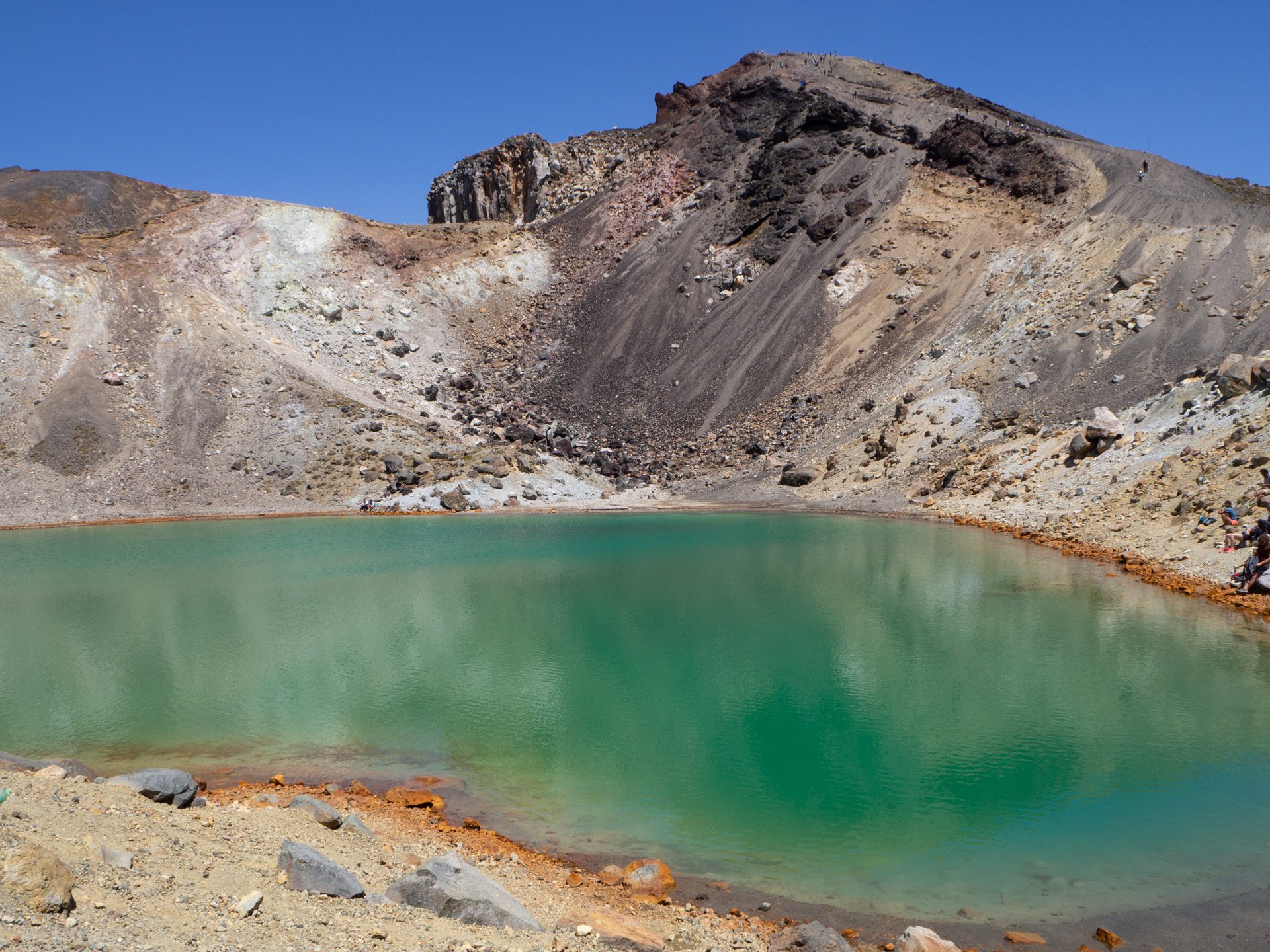
A shuttle bus took us to the start of the track and guess what? Sunshine! Ok, now it’s just 19.4km of hiking track, 1196m change of altitude and many other hikers with the same goal.
Elevation profile
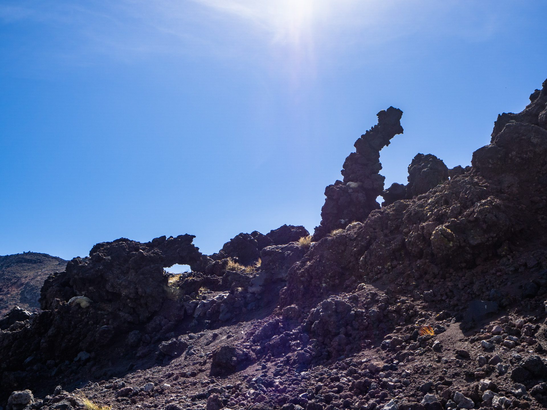
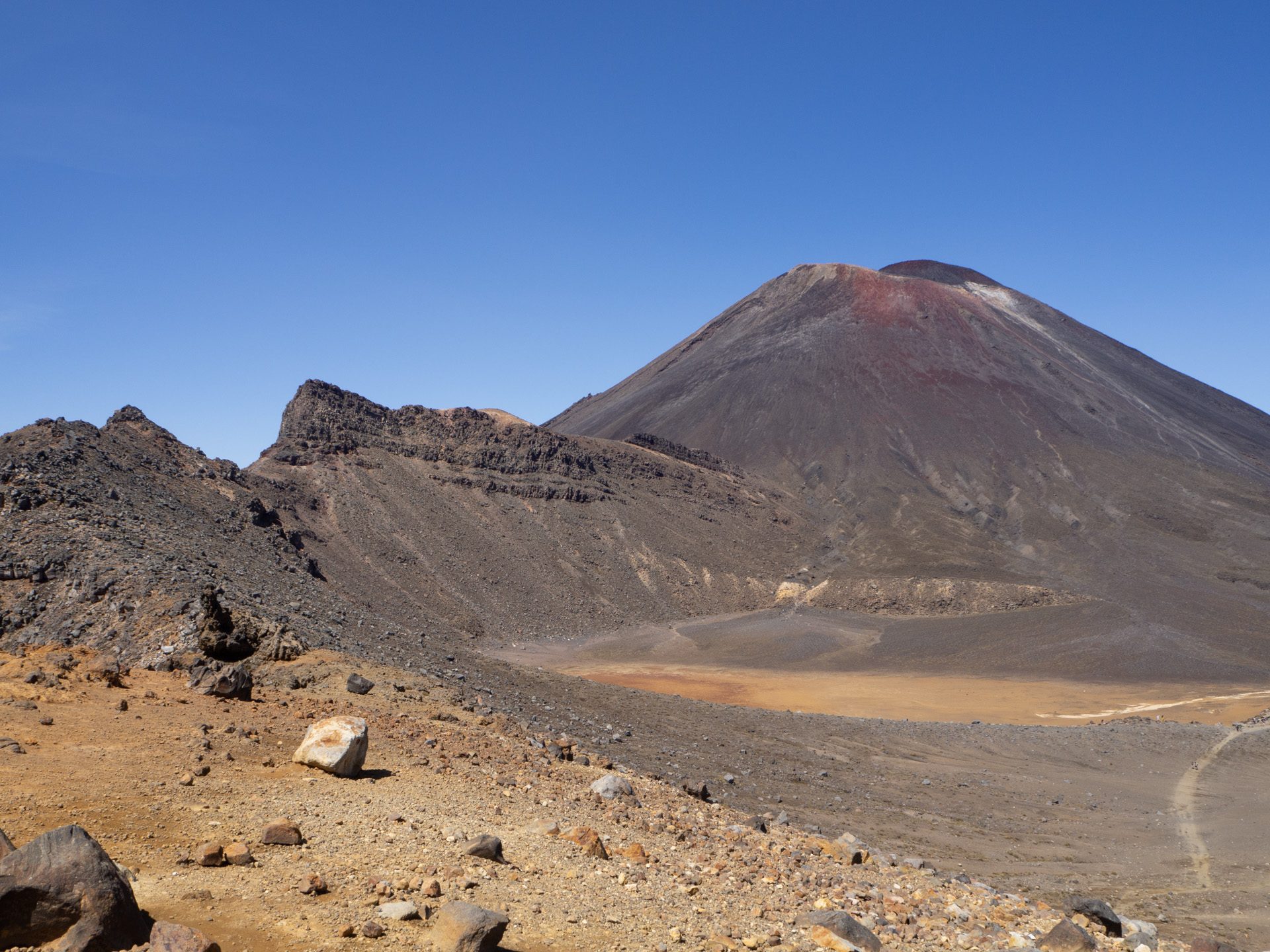
It’s difficult to describe this track better than DOC has done it already (see above). So from our side just the confirmation, that this hike should really be on your bucket list for New Zealand. Wandering over not-so-old lava flows, seeing the stunning colors, smelling the sulfur scents, hearing the steam vents and overlooking crater landscapes out of this world was just… wow!
It took us almost exactly 6 hours (incl. breaks) to reach the end of the track and the bus stop. Guess what? We just arrived on time for one of our shuttle (they run every hour) and it had just four seats left.
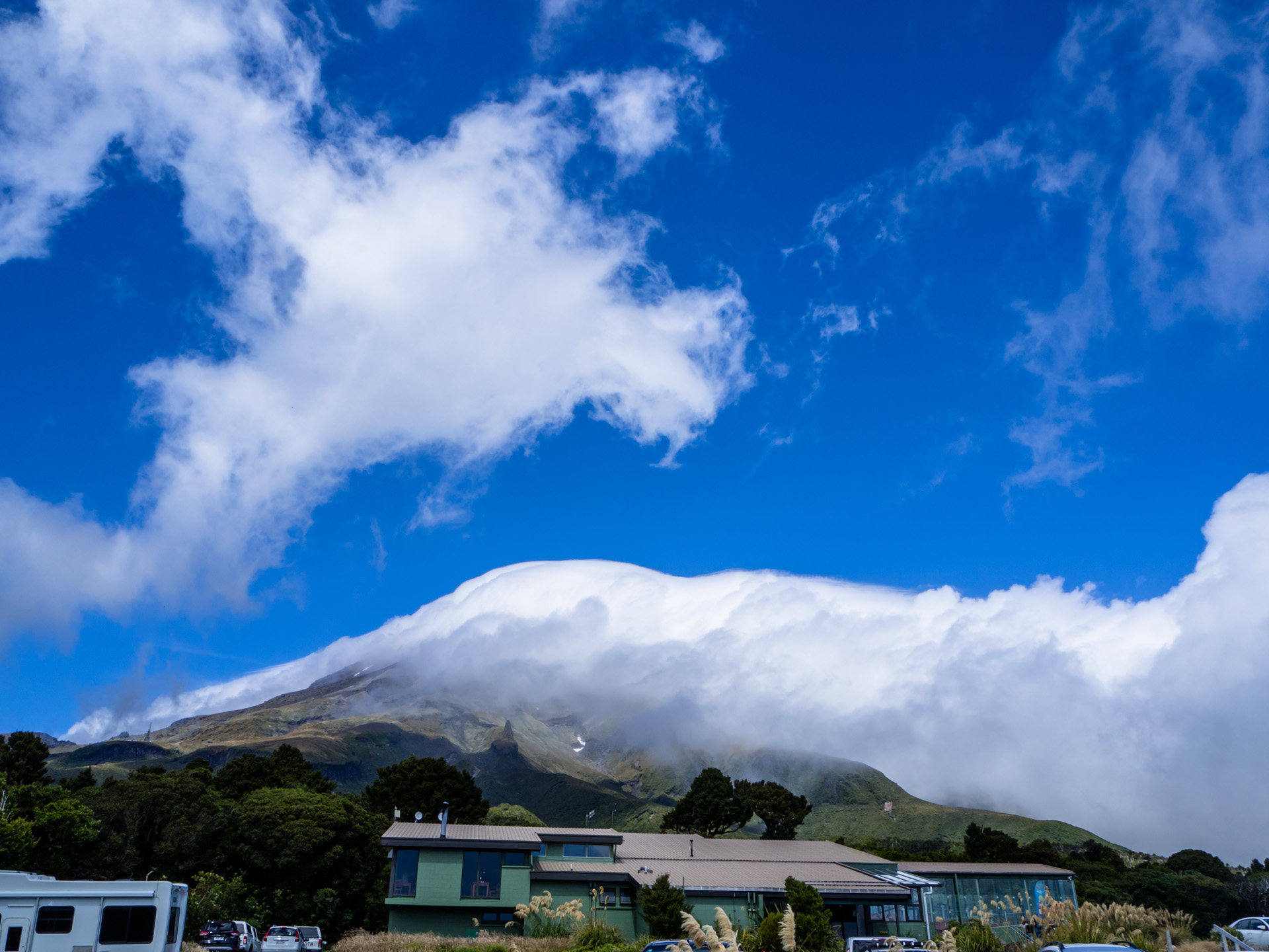
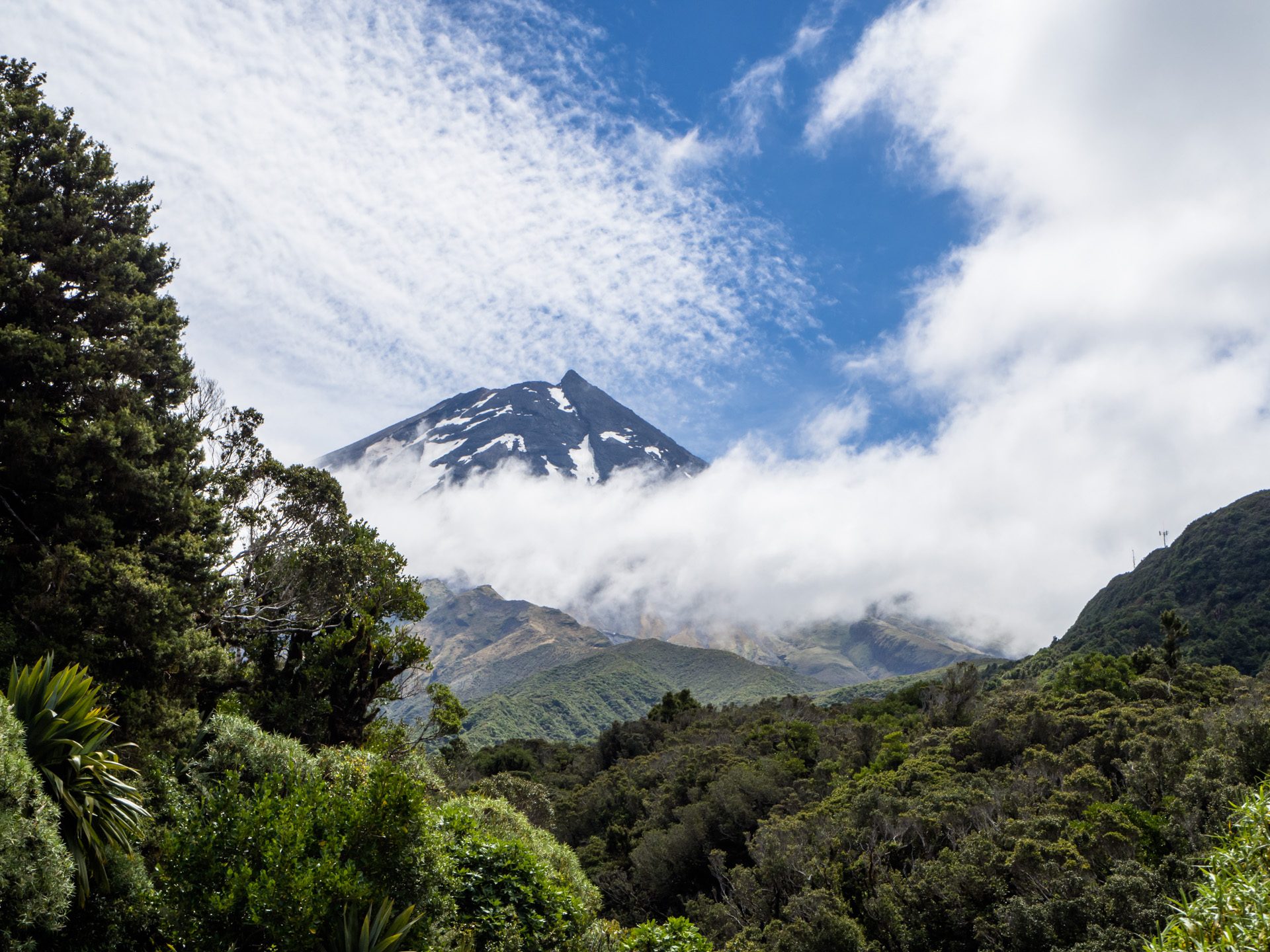
To fill our day we first visited Mount Taranaki again in the morning, but from a different entrance. He was hidden within clouds but we enjoyed the short walks nevertheless.
Mount Taranaki – disguised
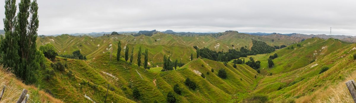
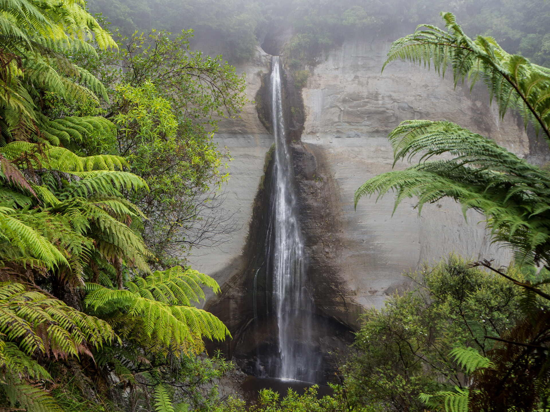
Stratford is the beginning (or end) of the Forgotten World Highway, an old scenic route with four “saddles”, a tunnel, little towns, a few detours and an unsealed section. A curvy (yep, New Zealand…) but enjoyable drive. A short walk to the Mount Damper Falls was a worthwhile break from driving.
Mount Damper Falls
Todays destination was Tongariro National Park Village where we booked the shuttle for tomorrow’s big hike.
After a rather boring ride towards Egmont National Park everything changed to the good. The impressive (and active) stratovolcano Mount Taranaki (2518m) – often hidden within clouds – got rid of his disguise.
Volcano Mount Taranaki
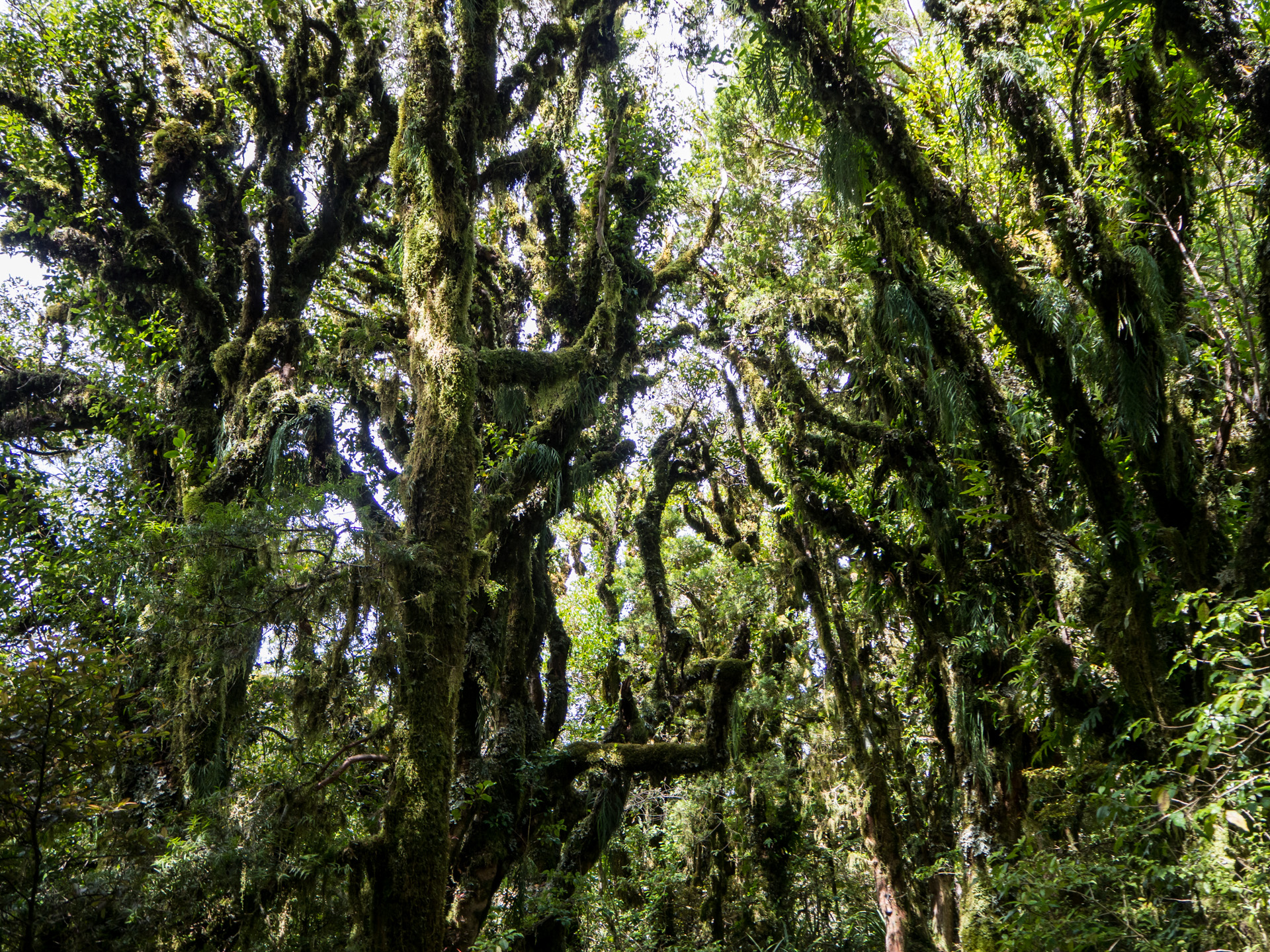
Mount Taranaki’s last major eruption was 1854, some scientists say the next one is overdue. From the visitor center we started to hike on the Wilkies Pools loop and extended it to the Waingongoro Hut. You walk within a “Goblin Forest” and we understood why. A forest from a fairytale, indeed.
A “Goblin Forest” from another world
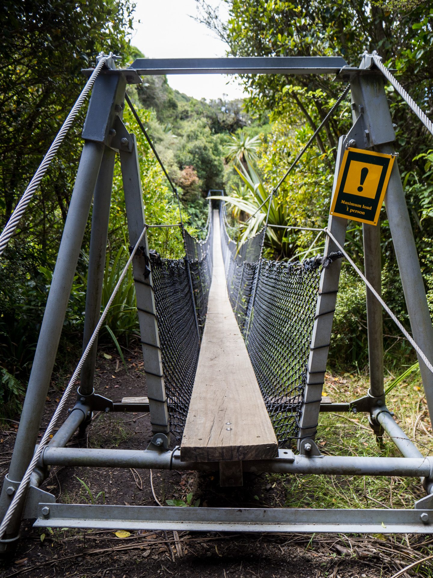
Another highlight was the one-person-only swing bridge over a deep canyon, offering a view on Mount Taranaki.
Swing Bridge
Mount Taranaki
Before returning to the campervan we also visited the Dawson Falls.
Dawson Falls
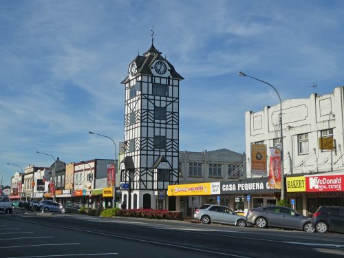
We spent the night in Stratford, where we enjoyed a “Glockenspiel” (play of bells, but they used the German expression, too) and a walk in the park.
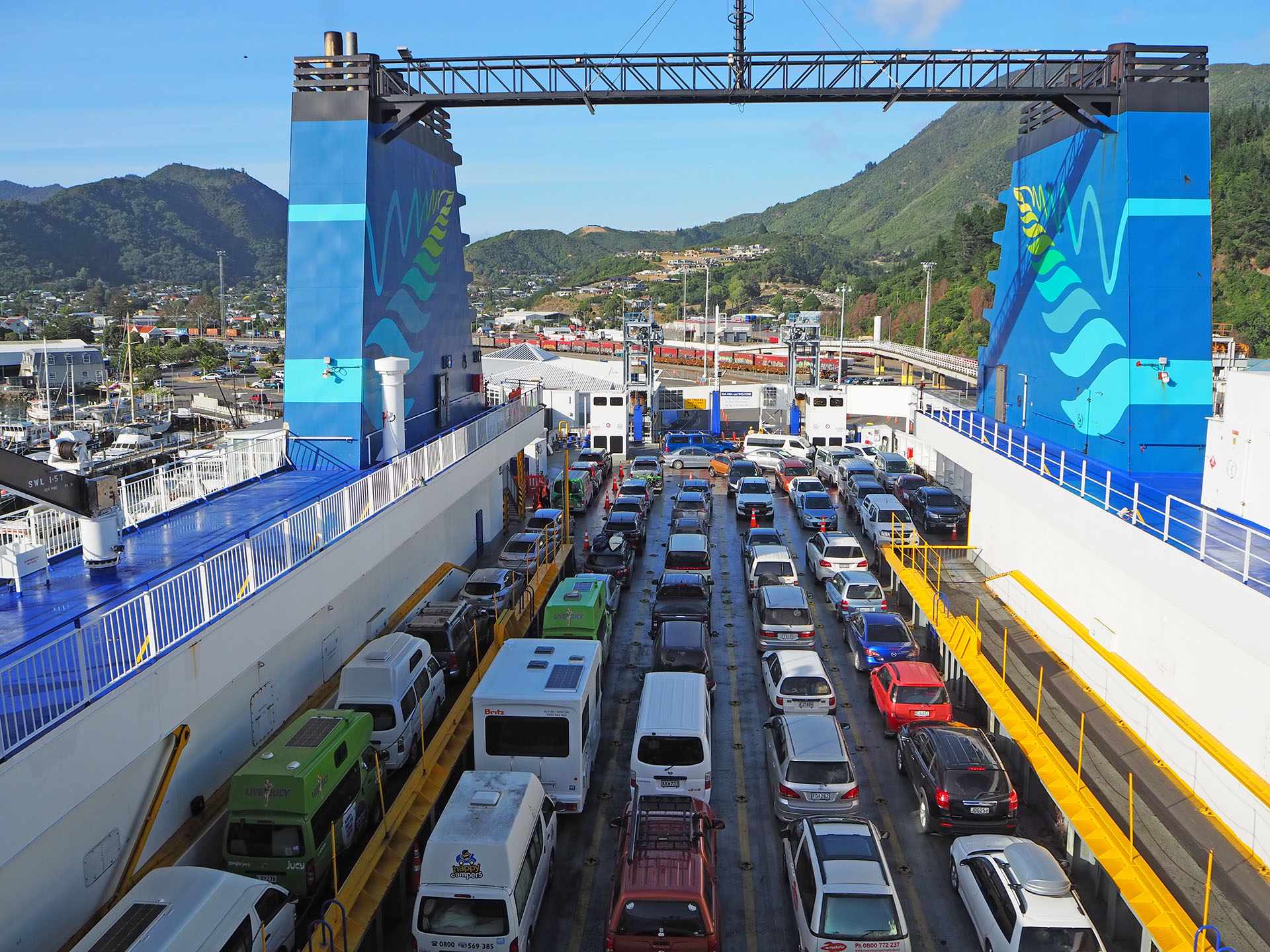
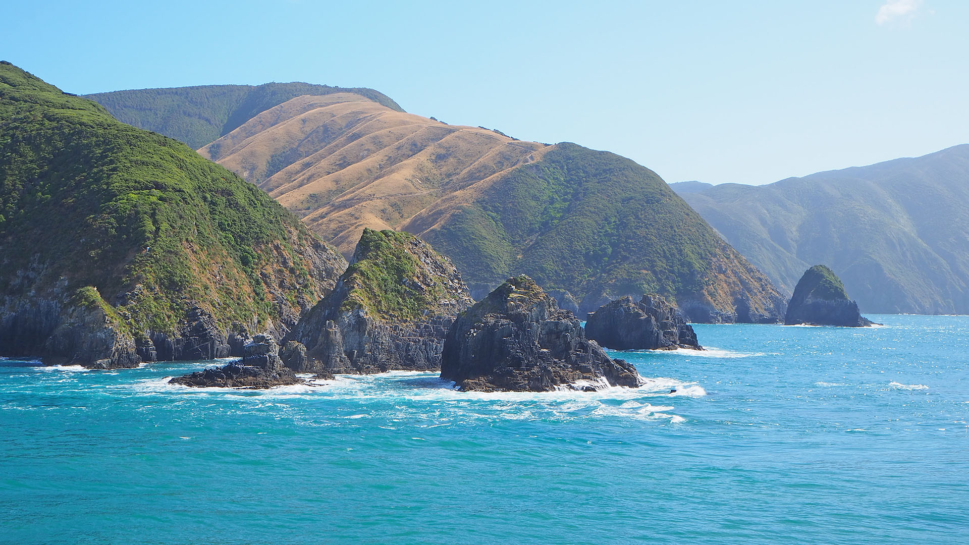
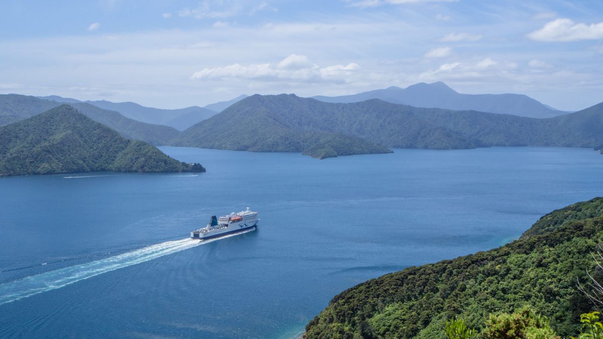
Leaving South Island. It was a nice ride on the Interislander ferry through the sounds of the South Islands to Wellington.
On the Interislander ferry
We could also spot (but not photograph) two dolphins along the way.
Last cliffs of the South Island
Unfortunately,
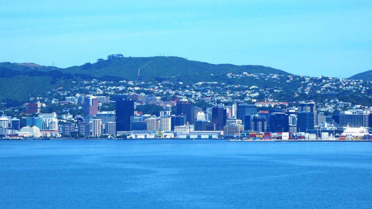
the capital of New Zealand is not very campervan friendly. It was not easy to
find a legal parking place for a van requiring a clearance of 3.2m. In the end
we gave up and left the city without having seen much of it. Maybe next time. We
drove till Paraparamau Beach and comforted us with a good early dinner.
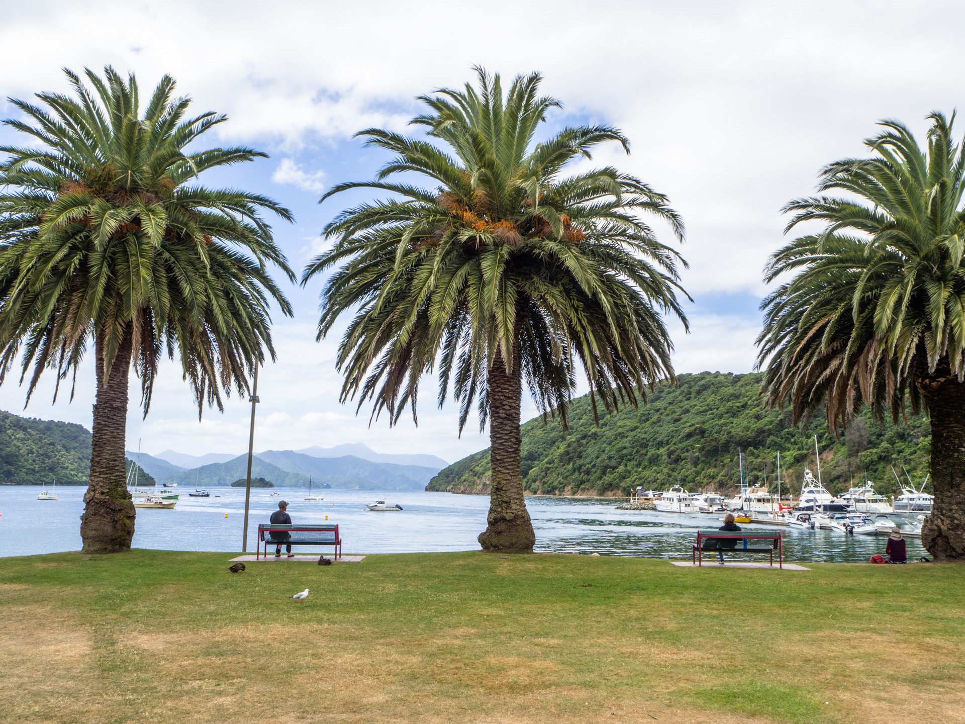
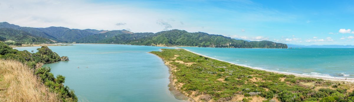
Just a short drive today to Picton, a small but important town, as the inter-island ferries drive from here to Wellington, North Island. So it’s our last day on the South Island, which we used to hike (again), doing the “Snout Track” along Queen Charlotte Sound to earn a good beer at “The Thirsty Pig”.
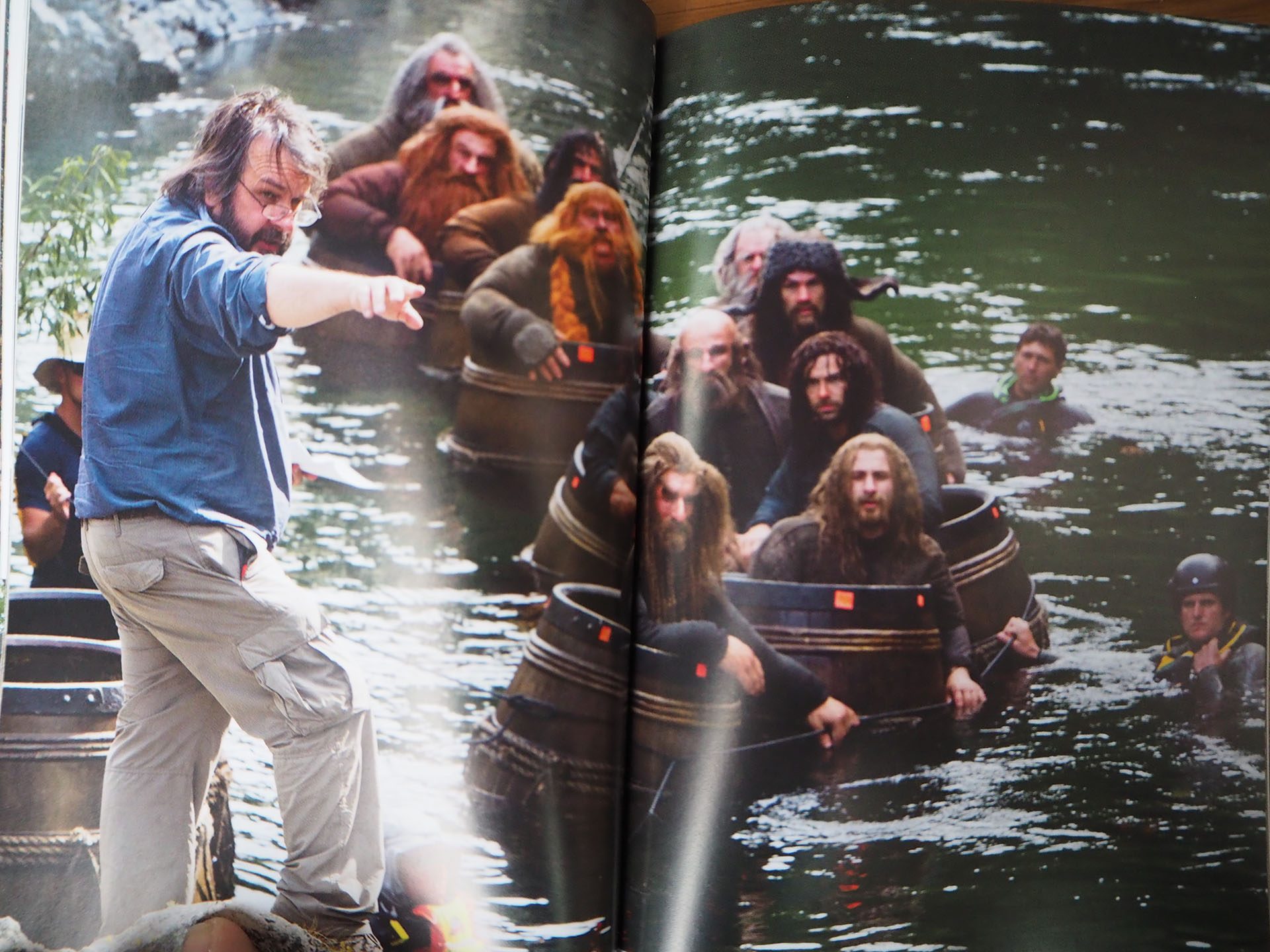
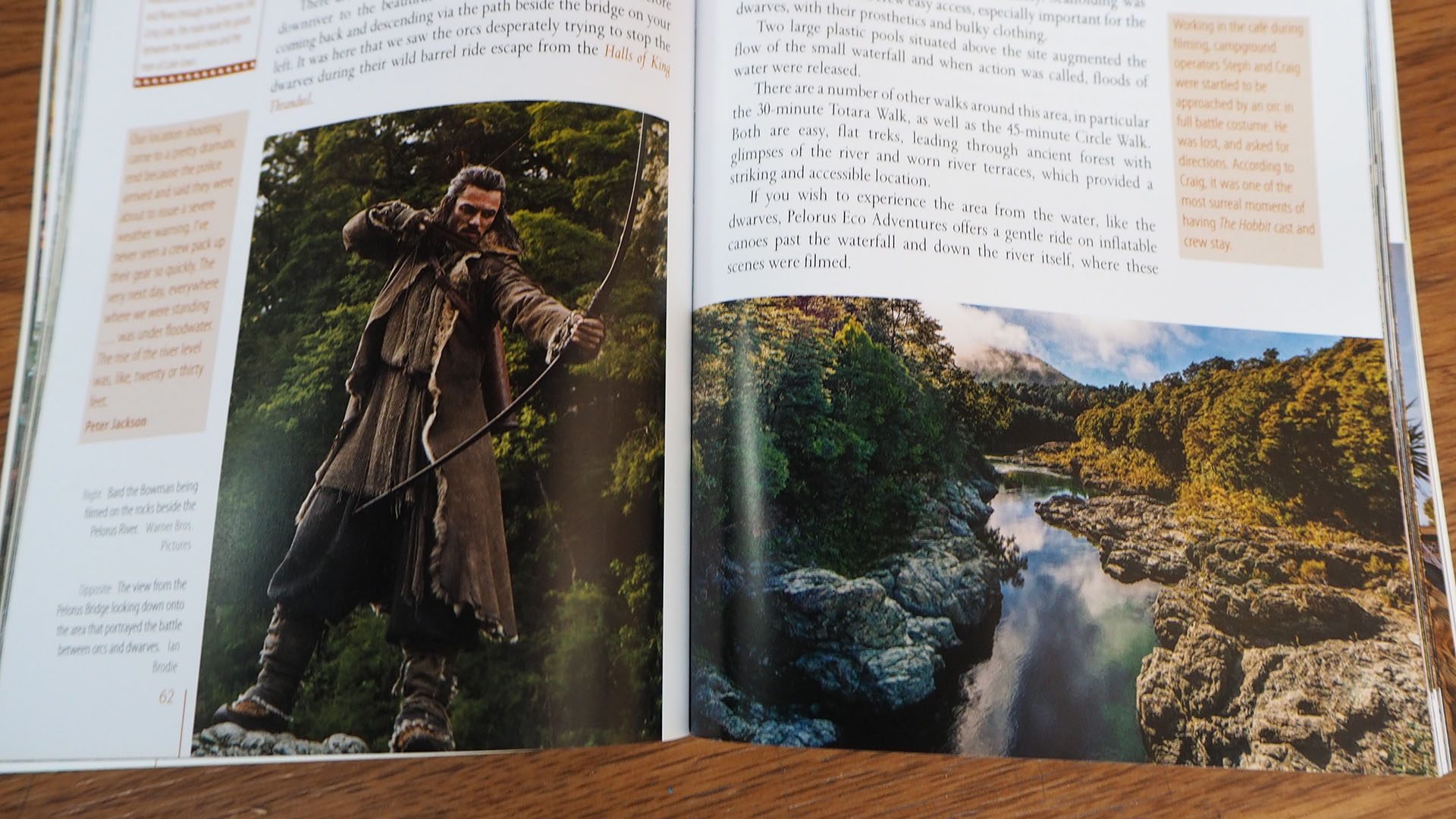
A quick stop for a short walk at Pelorus Bridge between Nelson and Havelock. Main reason: the scenery is part of the “barrel scene” in “The Hobbit 2” movie. Need to watch it again!
Peter Jackson and the dwarves
Yep, same location!
If we only had it since beginning!
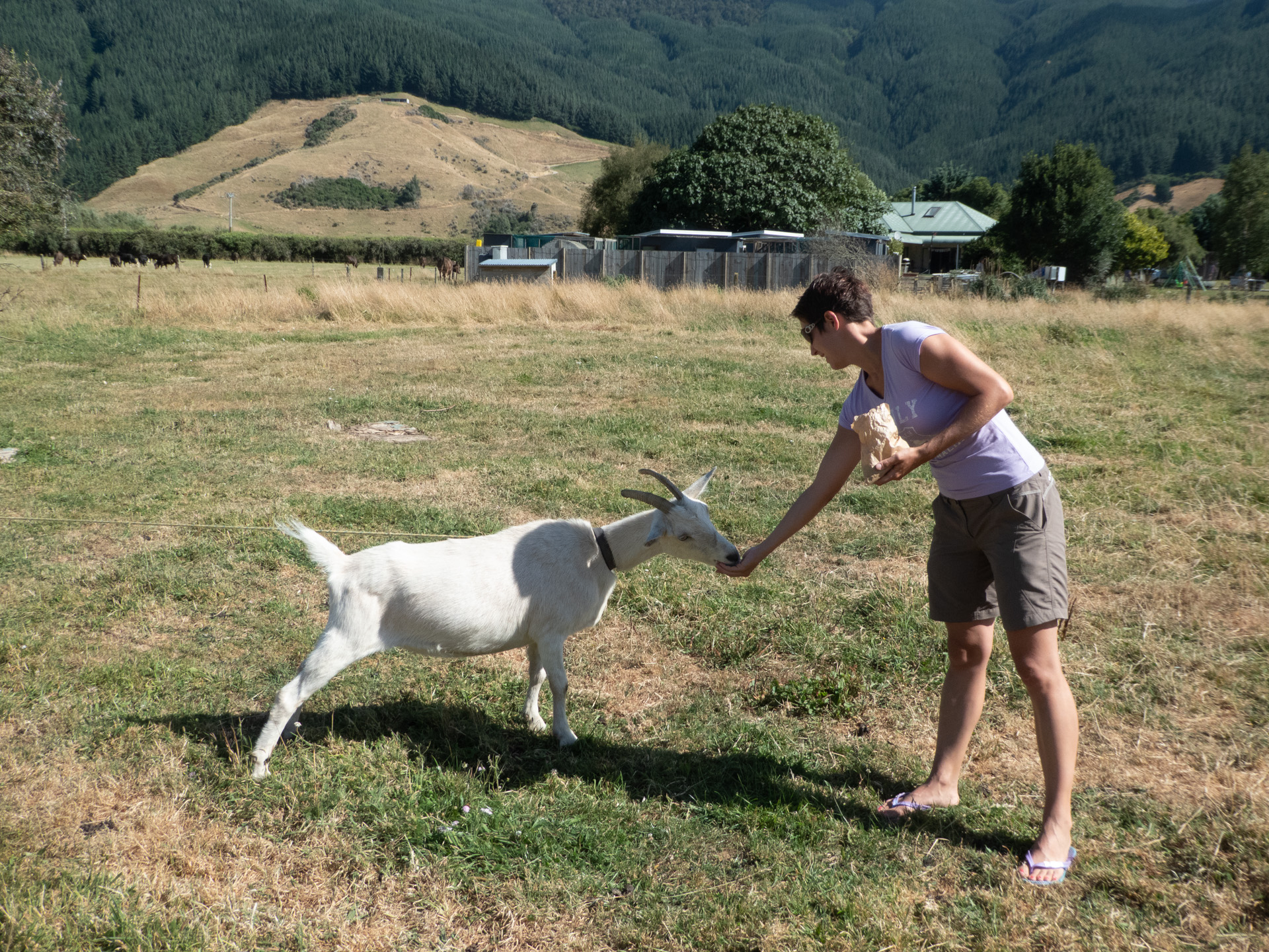
We arrived early at Smith’s Farm, which is also a campground. But so far the most personal one. Muffins as welcome gifts, food for the animals which you can feed and tips for Picton. And the recommendation to look for glowworms in the evening, which we had to skip due to uncertain weather conditions.
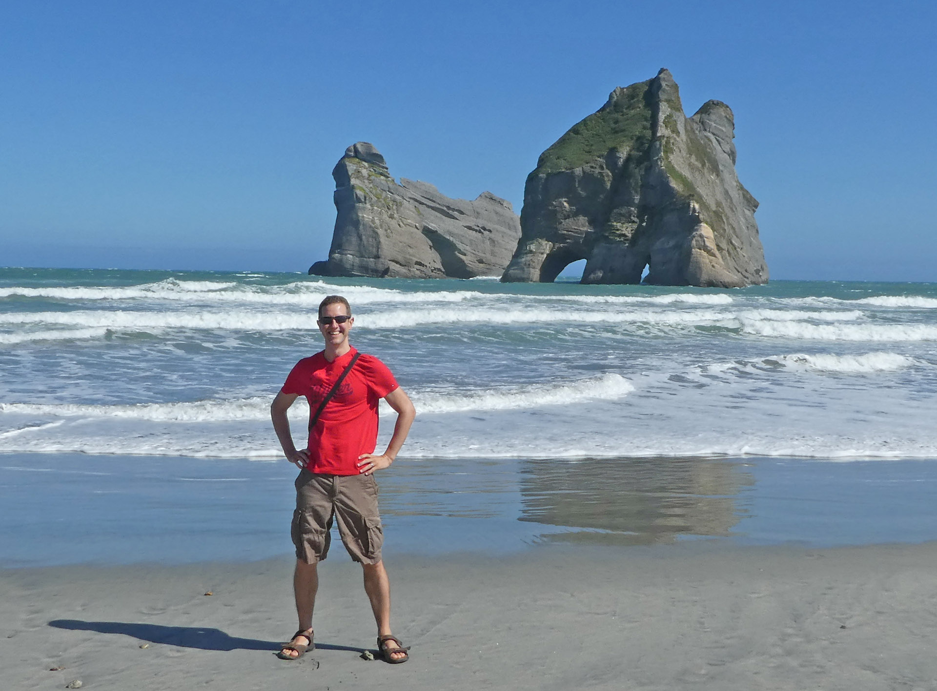
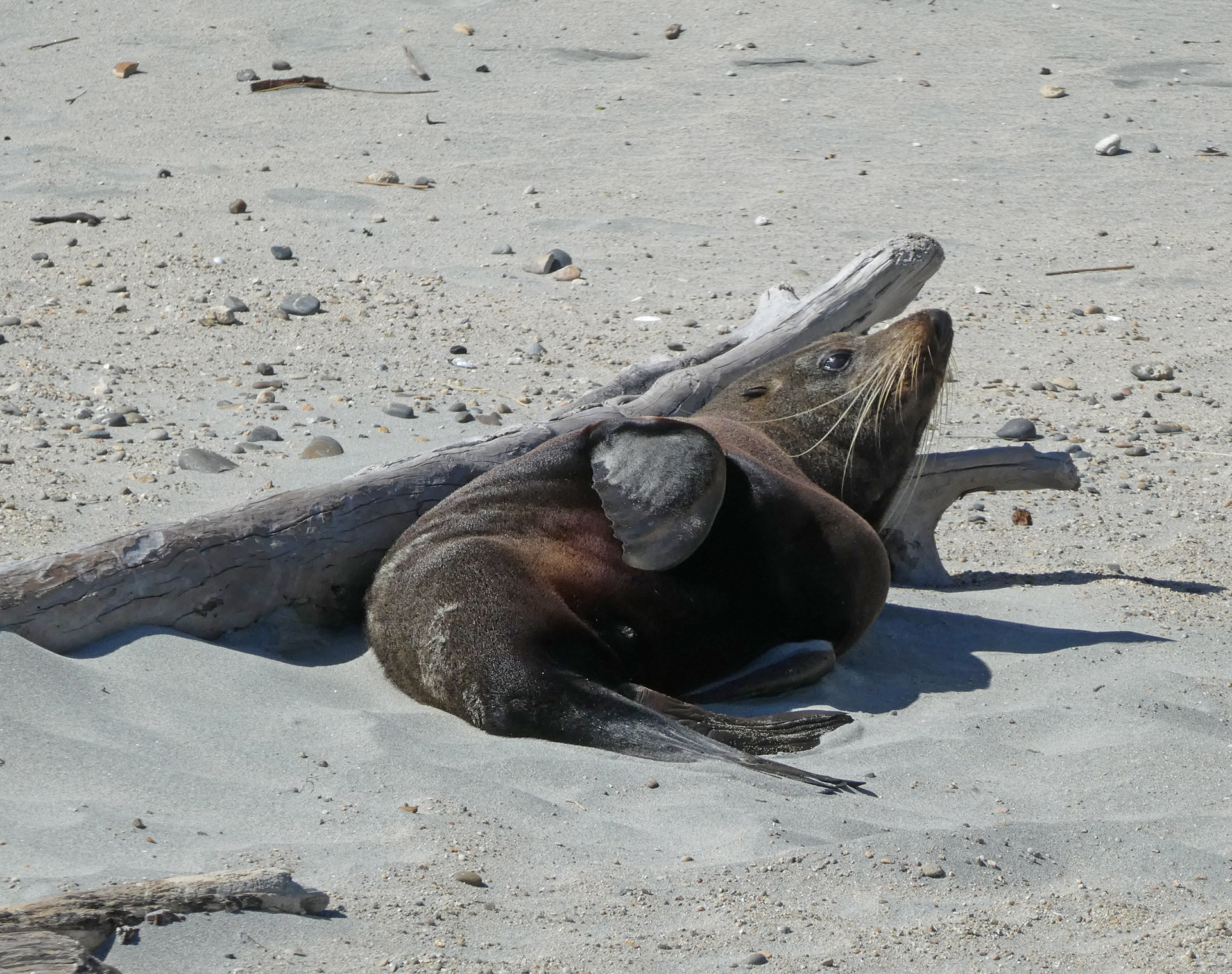
A short walk to Wharariki Beach in the morning was a pleasant start for this day. The Archway Islands look amazing in the wild ocean, a significant contrast to the seal laying at the beach.
Archway Islands at Wharariki BeachSeal at Wharariki Beach
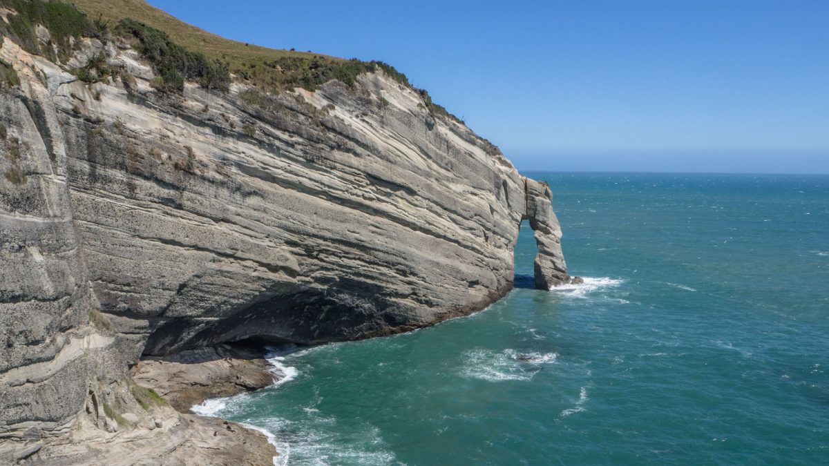
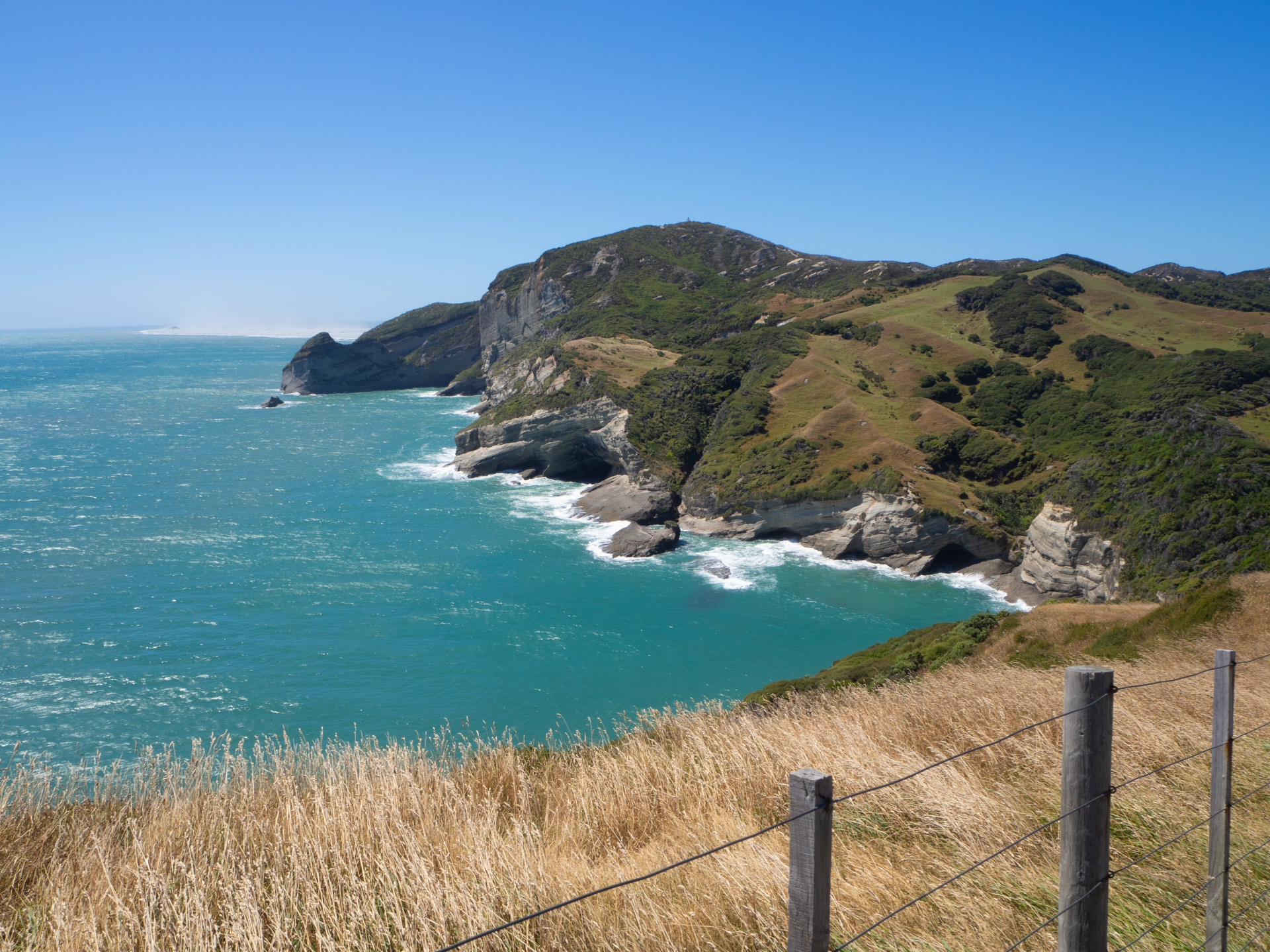
Just a five-minutes-drive away you reach Cape Farewell, the northernmost point of the South Island. Stone arch, seals, and in the distance Farewell Spit, a massive sand bank. Again a scenery almost out of this world.
Cape Farewell – Farewell Spit in the distance (the sandy thing)
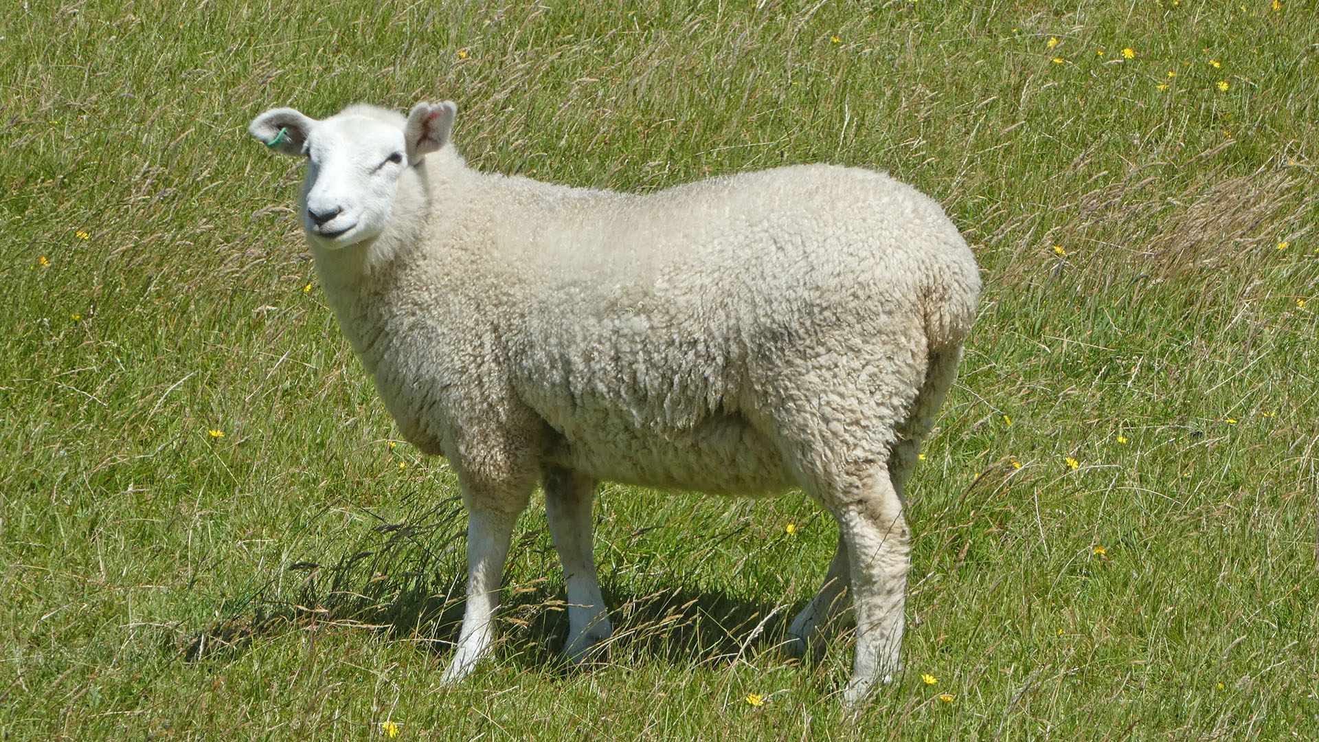
But we had to take care of the strong wind blowing over the cliffs – and of the sheep poo. To get a nice picture of a typical New Zealand sheep Gerry had to sing a Peach Weber song: “Bäääähsame, bäääähsame mucho” – and it worked!
Bäääähsame…
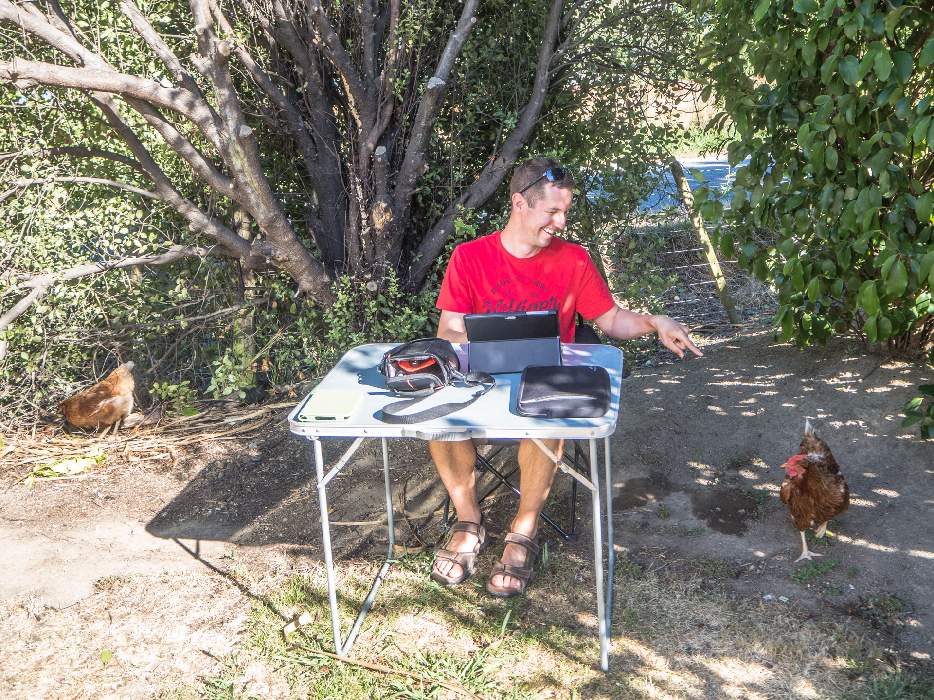
A rather long drive to the Cable Bay near Nelson to set up our camp at a farm. This time no kangaroos, but dogs and chicken freely wandering between the camper vans. We liked it!
Time to use our legs again. We started with an easy walk to the Wainui Falls. Tipp: go early or late, on our return the parking lot was very busy.
Wainui Falls
Close to
the falls is the starting point for a few hikes. Actually, we wanted to do an
easy hike along the coast to Taupo Point but the track is flooded during high
tides. And somehow, we missed the alternative way, so at the end we walked up to
Gibbs Hill (405 m.a.s.l.). Sigh! At least we got a good view over the bay at
different tide heights.
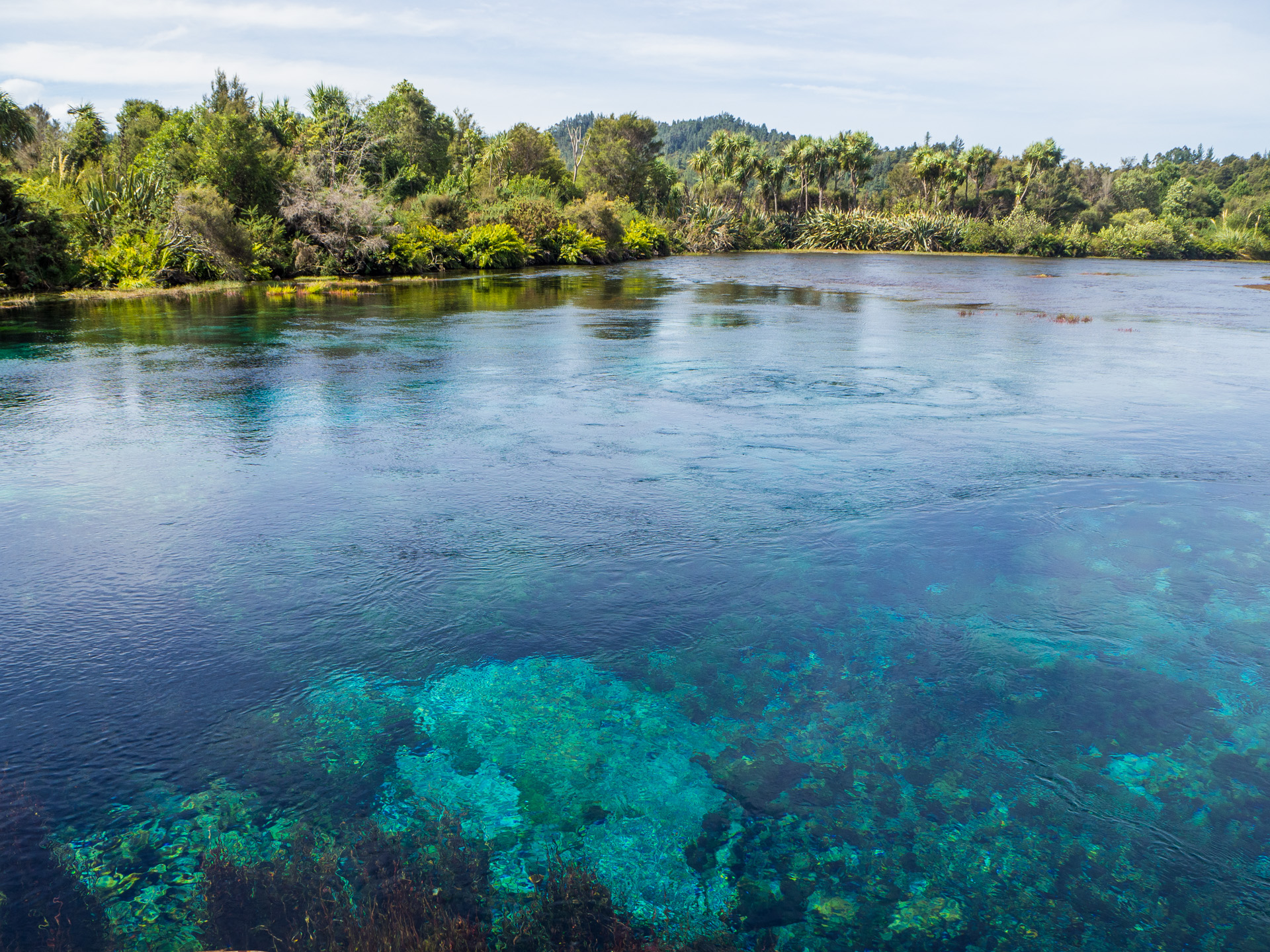
Much easier was the last short walk to the Te Waikoropupu Springs, a sacred place with some of the purest water in the world.
Te Waikoropupū Springs
Oh yeah, the Kiwis say “tramping” instead of “hiking”. We camped in Pakawau at an old-fashioned campground (the host used a magnifying glass to find our booking).